
The world is full of natural features that shape how we live, travel, and even think about our surroundings.
From the high peaks that rise above the clouds to the wide stretches of open water, each feature tells a story about the Earth’s history.
When you start to notice these patterns, you realize they’re not just part of a school subject but a key to understanding daily life, climate, and culture.
Today, I’ll show you how landforms and bodies of water connect everything, from the ground you walk on to the water that keeps you alive. Let’s begin by looking at what these features really are.
Landforms and Bodies of Water
Learning about landforms and bodies of water helps you see how Earth is shaped. These features are more than just scenery; they affect weather, where people live, and how plants and animals survive.
What Are Landforms?
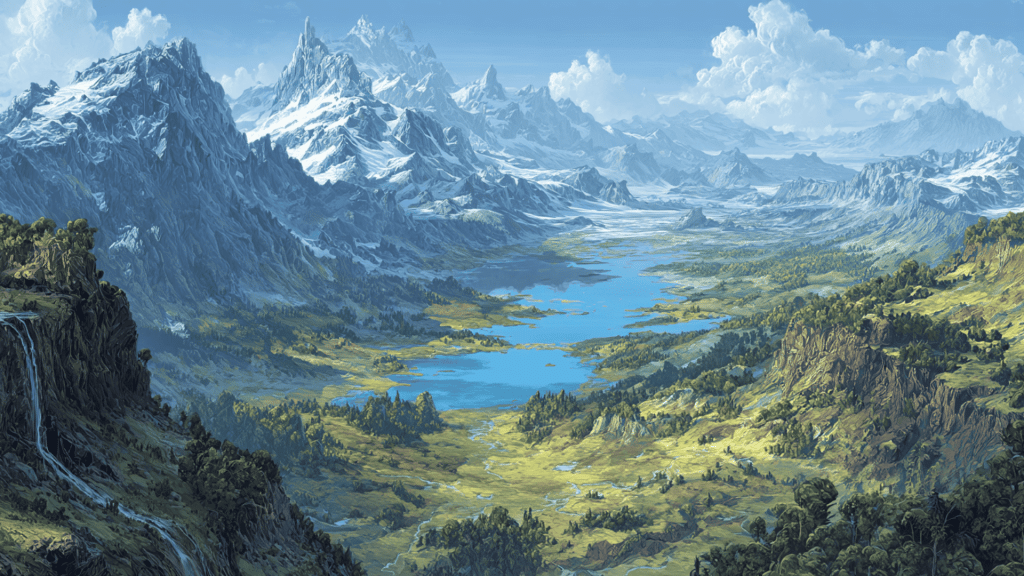
Landforms are the natural shapes and structures you see on Earth’s surface. They form over time through powerful forces like wind, water, ice, and moving tectonic plates.
Each landform has its own look, and many become landmarks we recognize around the world. Here’s a quick look at some different types of landforms and real-world examples:
| Landform | Description | Famous Example |
|---|---|---|
| Mountain | Tall, rocky area rising sharply above the land | Himalayas (Asia) |
| Valley | Low area between hills or mountains, often with a river | Great Rift Valley (Africa) |
| Plain | Large, flat stretch of land with few trees | Great Plains (USA) |
| Plateau | Flat, elevated area higher than nearby land | Colorado Plateau (USA) |
| Canyon | Deep, narrow valley with steep sides | Grand Canyon (USA) |
| Desert | Dry region with little rainfall and sparse vegetation | Sahara Desert (Africa) |
| Cliff | Steep rock face, often along coasts or rivers | Cliffs of Moher (Ireland) |
Landforms give every region of the world a unique character and influence how people adapt to their surroundings.
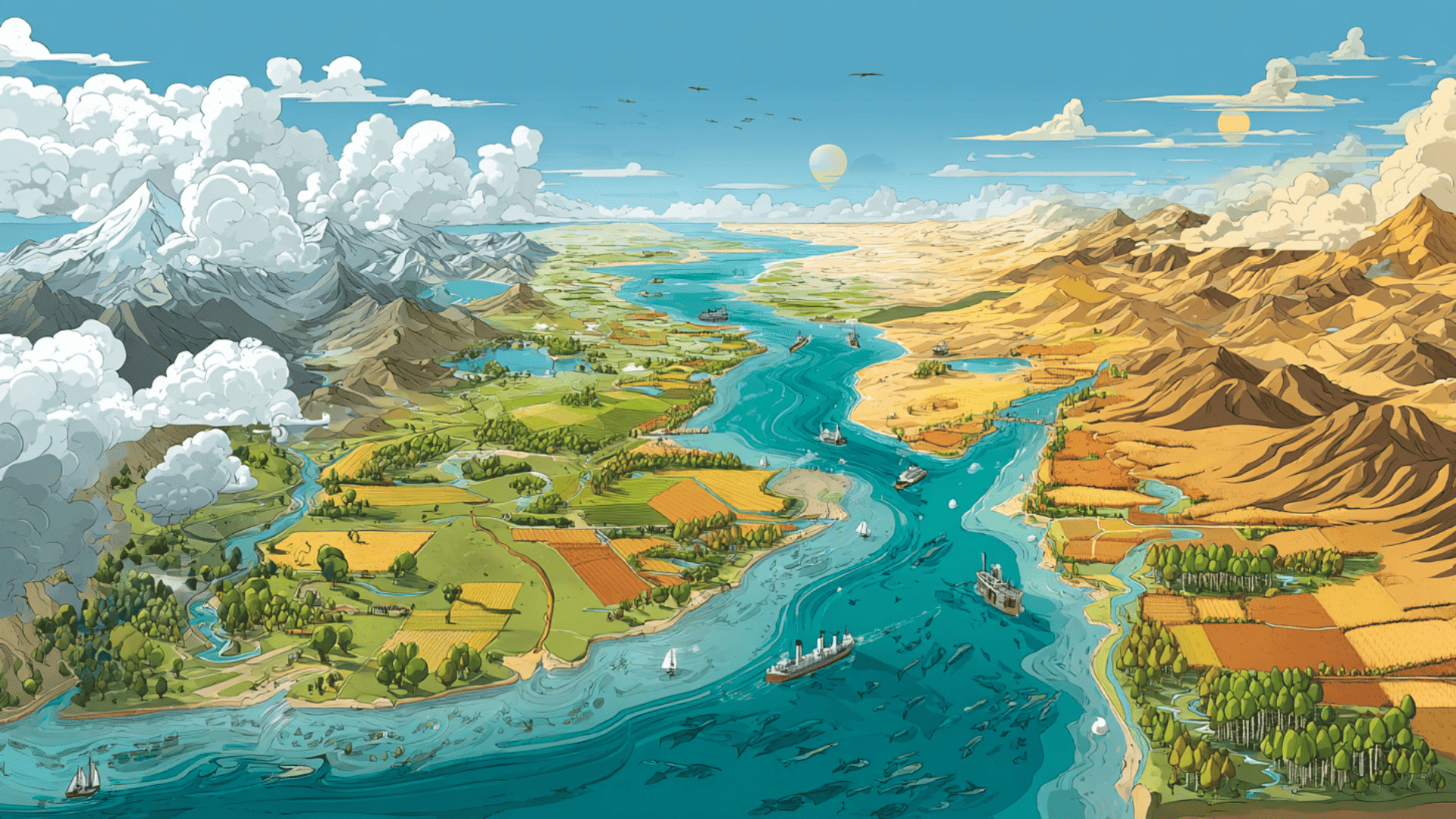
What Are Bodies of Water?
Bodies of water are natural collections of water on Earth’s surface. They can be fresh or salty, small or massive, still or flowing. They provide drinking water, food, and travel routes, while also shaping weather and ecosystems.
Here’s a breakdown of the main types of bodies of water and well-known examples:
| Body of Water | Description | Famous Example |
|---|---|---|
| Ocean | Vast body of salt water covering much of Earth | Pacific Ocean |
| River | Flowing stream of water moving across land | Amazon River (South America) |
| Lake | Large body of water surrounded by land | Lake Victoria (Africa) |
| Pond | Small, still body of water surrounded by land | Walden Pond (USA) |
| Bay | Wide inlet of the sea with land curving around it | San Francisco Bay (USA) |
| Waterfall | Water dropping from a height, usually over rocks | Niagara Falls (USA/Canada) |
Bodies of water play a central role in life on Earth, shaping landscapes, providing resources, and supporting countless species.
How They Are Formed
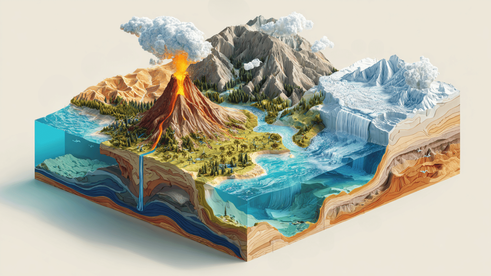
The Earth is always changing, even if you don’t notice it right away. Landforms and bodies of water take shape over thousands or even millions of years through powerful natural processes.
Landforms
Landforms are shaped by both slow and sudden forces. Some build land up, while others wear it down.
- Tectonics: The Earth’s crust is divided into plates that move. When they push or pull apart, they create mountains, valleys, and rift zones.
- Erosion: Wind, water, and ice gradually wear away rock and soil, carving features like canyons and cliffs.
- Weathering: Rocks break down into smaller pieces from temperature changes, plant roots, or chemicals in water. Over time, this reshapes the landscape.
- Volcanic Activity: When magma rises and erupts, it forms volcanoes, islands, and plateaus.
Together, these forces keep the Earth’s surface in constant motion, creating the landforms we see today.
Water Bodies
Water bodies form when water collects in low-lying areas or flows across the land. Different processes feed and shape them.
- Glacial Melt: Melting glaciers leave behind deep depressions that fill with water, forming lakes and rivers.
- Rainfall: Heavy and repeated rains gather into streams, ponds, and wetlands.
- Plate Movement: Shifting plates create basins that oceans and seas fill over time.
- Natural Basins: Low areas in the ground trap water, forming ponds, lakes, and even inland seas.
These processes explain why water shapes so much of our planet’s surface and supports nearly all forms of life.
Why Landforms and Bodies of Water Matter
Landforms and bodies of water aren’t just parts of the landscape. They shape the way the Earth works and play a big role in how people and nature live.
1. Impact on Climate and Weather
Mountains, oceans, and plains all affect the weather you feel every day. Mountains can block winds and create rain shadows, leaving one side wet and the other side dry.
Oceans and lakes store heat and release it slowly, which helps nearby areas stay warmer in winter and cooler in summer. Deserts and plains heat up and cool down quickly, which often leads to extreme temperature changes.
2. Role in Human Settlement, Agriculture, and Trade
Where people live has always depended on landforms and water. Rivers and lakes provide fresh water for drinking, farming, and transportation. Fertile plains and valleys make it easier to grow crops and raise animals.
Oceans and bays open up trade routes that let goods and ideas move between regions. Even today, most big cities are still built near rivers, coasts, or flatlands because those features make life easier.
3. Importance for Ecosystems and Biodiversity
Every landform and water body creates a home for living things. Forests grow on mountain slopes, while deserts support plants and animals that adapt to dry conditions.
Wetlands and rivers are full of fish, birds, and smaller creatures. Coral reefs and coastal waters hold some of the richest biodiversity on Earth.
Without these features, ecosystems wouldn’t exist the way they do, and life on Earth would look very different.
Identifying Landforms & Water Bodies on Maps
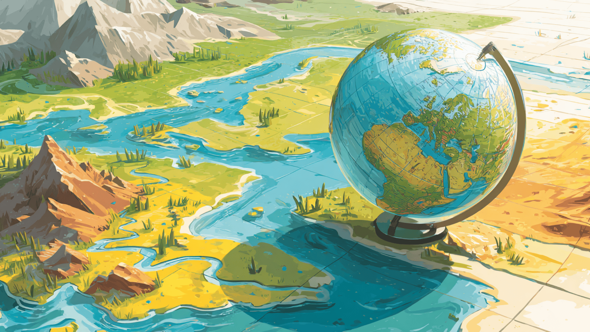
Maps and globes are more than tools for finding places. They help you see how land and water are spread across Earth and make it easier to connect what you learn with the real world.
1. Use of Maps and Globes
Maps and globes show Earth in different ways. A globe gives you the big picture of the entire planet, while a flat map helps you focus on smaller regions. Both are useful for spotting landforms like mountains and plains, and water bodies like rivers and oceans.
2. Symbols and Representations
On a map, colors and shapes represent natural features. Mountains may appear as small triangles or shaded areas. Rivers and lakes are usually marked in blue. Deserts often use yellow or tan, while forests are shaded in green. Once you know the symbols, maps become much easier to read.
3. Example Activity: Practice With a Labeled Map
A good way to learn is to practice with a labeled map. Start by pointing out the rivers, lakes, and oceans.
Then find the mountains, valleys, and plains. The more you practice, the quicker you’ll get at recognizing these features without needing help.
4. Common Map Symbols
Here’s a quick table you can use as a reference when reading maps:
| Symbol | Feature |
|---|---|
| ▲ | Mountain |
| ▬ or shaded brown | Plateau |
| Blue line | River |
| Blue circle/patch | Lake or pond |
| Wavy blue area | Ocean or sea |
| Yellow or tan area | Desert |
| Green area | Forest or plain |
Using these symbols makes it much easier to pick out landforms and bodies of water at a glance.
Fun Learning Activities
Learning about landforms and bodies of water doesn’t have to feel like study time. You can make it fun with simple activities that bring the concepts to life.
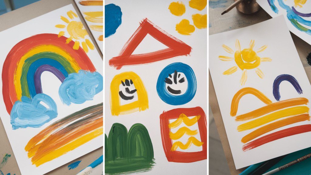
- Drawing Activities: Sketch landforms like mountains, valleys, and plateaus, or water bodies like rivers and lakes. Use colors, blue for water, green for plains, and brown for mountains, to make them easy to remember.
- Create a Mini Map: Design your own map of a pretend place. Add rivers, mountains, and plains, then mark them with simple symbols. This helps practice map reading while being creative.
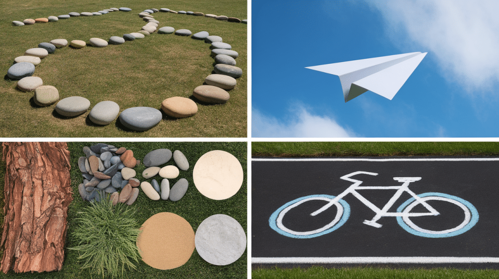
- Hands-On Models: Use clay, sand, or playdough to build landforms and water bodies. Shape mountains, carve rivers, or flatten areas into plains. This makes geography feel more real.
These small projects keep learning active and fun, while also making it easier to remember what each landform and water body looks like.
Wrapping Up
Learning about landforms and bodies of water gives you a better way to understand the world around you. These features don’t just shape the planet; they also influence how people live, how animals survive, and how weather patterns move.
Once you start noticing them, you’ll realize they’re part of daily life, from the mountains in the distance to the rivers that support towns and cities.
Paying attention to these details helps you connect classroom knowledge with the real outdoors in a way that feels practical and meaningful.
If you’d like to keep reading more simple explanations and useful guides, check out my other blogs on the website.